Military Geographical Institute
The Military Geographical Institute "General Stevan Bošković" is an institution of the Serbian Armed Forces in charge of providing the defense system with geospatial data relating to the territory of the Republic of Serbia.
The Institute is directly subordinate to the Intelligence and Development Affairs Directorate (J-2) of the Serbian Armed Forces General Staff.
The Military Geographical Institute "General Stevan Bošković" is an accredited scientific and research institution. Thanks to the established cooperation with numerous scientific and educational institutions, the Institute successfully implements scientific research projects in the field of geology.
Tasks of the Military Geographical Institute "General Stevan Bošković"
In order to provide the necessary geospatial data, the Military Geographical Institute "General Stevan Bošković" performs:
- Air recordings,
- Photogrammetric surveying,
- Topographic surveying,
- Cartographic processing,
- Data publishing,
- Printing of maps,
- Storage and distribution of maps,
- Research and development and
- Training of users.
The current tasks of the Military Geographical Institute "General Stevan Bošković" are:
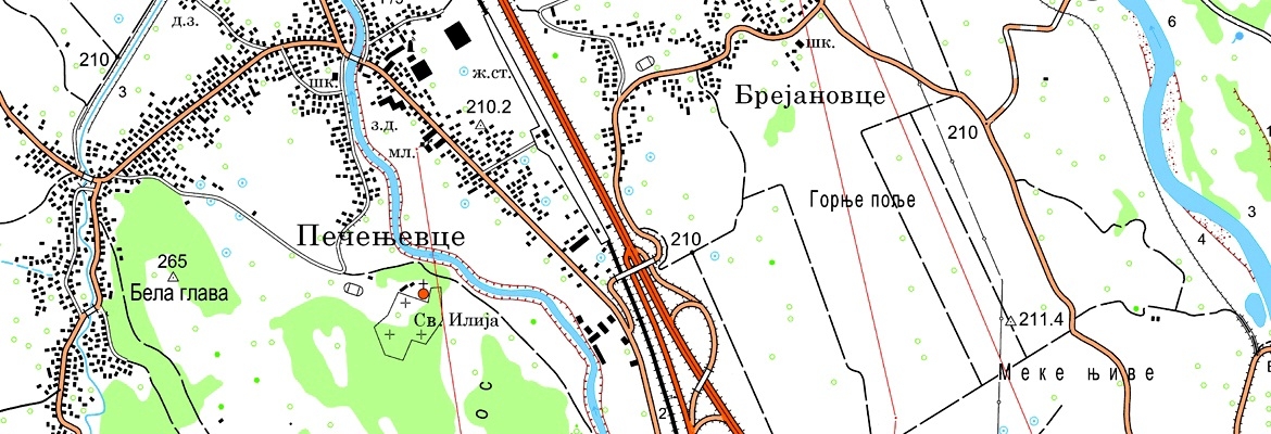
- Topographic map 1: 25.000,
- Topographic map 1: 50.000,
- Topographic map 1: 100.000,
- Topographic map 1: 250.000,
- Geographical map 1: 750,000 i
- International map 1: 1,000,000.
In addition to these tasks, the Military Geographical Institute "General Stevan Bošković" participates in several projects of national importance, such as:
- IPA2014 project Recovery of Flood Damages,
- National Atlas of the Republic of Serbia and
- Serbian Encyclopedia.
Products of the Military Geographical Institute "General Stevan Bošković"
The Military Geographical Institute "General Stevan Bošković" produces various types of cartographic, graphic, photographic and textual-numeric products in digital and printed form.
The main products of the Institute are:
- Topographic maps,
- Geospatial database,
- Orthophoto products,
- Digital elevation model and
- Relief maps.
In addition to these products, the Military Geographical Institute "General Stevan Bošković" produces transparent topographic, geographical and thematic maps. Almost all products are available to civilian institutions.
The tradition of the Military Geographical Institute
The Military Geographical Institute is one of the oldest institutions of Serbian military. It was founded on February 5, 1876, as the Geographical Section of the Serbian Army General Staff. In 1920, it grew into the Geographical Institute (the Military Geographical Institute in 1923), the first military establishment that was termed the institute.
Since its foundation, the Institute has not changed its core mission – the development of maps for the military. In its long history, the Military Geographical Institute played a very important role in the development of Serbian geodesy, cartography and photogrammetry. It has conducted a number of projects of state importance, such as designing and establishing the first state trigonometric, level, gravimetric and GPS network. One of the most important tasks of the Institute was the first systematic topographic survey of the entire state territory, based on which a number of topographic maps were made.
The Military Geographical Institute, having inherited its long tradition, continued with the pioneering work and today applies state-of-the-art information technology for the development of topographic maps. In order to preserve the memory of people, events and results of work, the documentary The Military Geographical Institute Over Three Centuries has been filmed by the Military Film Centre Zastava Film.
Contact Information
Address: 5 Mije Kovačevića St., Belgrade
Phone: +381 (0) 11 3205-007
Fax: +381 (0) 11 3205-350
Email: vgi@vs.rs


